Last Updated: August 28, 2025
Monteverde is one of Costa Rica’s most unique destinations. This humble mountain town, best known for its foggy cloud forests, is far removed from other tourist destinations. And because it sits on its own, how to get to Monteverde is often a topic of interest or even concern. Indeed, driving to Monteverde is an adventure, but it can be fun if you are prepared. In this post, we’ll give you directions for the three most common routes to Monteverde, tell you what road conditions to expect, and give you rental car tips.
For information about road conditions all across Costa Rica, read our post Road Conditions of Specific Routes in Costa Rica.
Overview on Driving to Monteverde
Renting a car and driving yourself to Monteverde is one of the most common transportation options; however, it is not for everyone. Sure, the roads to this famous cloud forest destination have greatly improved over the years but they still aren’t perfect. There are steep sections, tight curves, and some drop-offs without much of a shoulder or even any guardrails!
If you do opt to drive, stay alert, take your time, and only travel during the day. This guide will also help you decide which routes are best, so you don’t get off track.
If you’re uneasy about driving to Monteverde, don’t worry, you can always leave that part up to the professionals. Both private and shared shuttles are available with drivers who are very familiar with these local roads. Reach out through our Shuttle Bookings page if you need help.
Note: Throughout this guide, when we say 4×4, we mean any vehicle with four-wheel drive (4WD) or all-wheel drive (AWD). It’s not necessary to have an off-road vehicle.

Best Routes to Monteverde
Route 606 to Monteverde (Through Guacimal)
- Best if driving to Monteverde from San Jose or central/southern Pacific coast destinations
- Paved but with some potholes
- Curvy and steep in sections
- Approximately 1 hour travel time from Route 1
If you are driving to Monteverde from San Jose, the SJO Airport, or destinations on the Pacific coast like Jaco, Manuel Antonio, Dominical, or Uvita, the best and most commonly traveled road is Route 606.
Route 606 starts at the Inter-American Highway (Route 1) and is marked by a gas station called Full. Once you get on Route 606, the drive to Santa Elena and Monteverde is about 36 km (22 miles) and takes approximately 1 hour.
Map of Route 606 to Monteverde
<
Route 606 Road Conditions
From Route 1 (at the gas station), Route 606 is paved all the way to downtown Santa Elena. The two-lane road winds through the town of Guacimal before becoming very rural. The road can be extremely curvy at times and you will gain elevation as you go. As you get higher, there are some fantastic views of the surrounding mountains and rolling farm fields.
There are some sharp curves, potholes, narrow spots (including a one-lane bridge), and steep cliffs or rocky embankments. If you are driving during the rainy season (May through November), small landslides or washouts can block or partially block the road. Road crews usually open things back up within hours though, as long as they aren’t too severe.

It is best to avoid driving Route 606 at night (sunset is around 6:00 p.m.) because there are very few guardrails and visibility can be poor due to clouds or rain. During the day, the drive is usually beautiful and you can see all the way to the Pacific Ocean from some viewpoints.
Here is a short video on driving to Monteverde via Route 606
This video was taken before the road was paved but still gives you an idea of the curves, elevation gain, and views.
History of Route 606
Not long ago, Route 606 was just a bumpy dirt road. Starting in 2018, the Costa Rican government began the process of paving the portion from Guacimal to Santa Elena. This was a huge undertaking and the road was detoured on and off for about two years during construction. Along the drive, you’ll see some of the impressive excavation that they did.
Route 145 to Monteverde (through Juntas)
- Best if driving to Monteverde from Guanacaste beaches, beach towns on the Nicoya Peninsula, or Bijagua
- Mostly paved but some flat sections are still gravel/dirt
- Curvy and steep in some parts
- Approximately 1 hour travel time from Route 1
- Don’t confuse this with 145 from La Fortuna/Lake Arenal; that section is covered below.
If you’re driving to Monteverde from Guanacaste Airport (LIR) near Liberia or points in Guanacaste like Tamarindo, Flamingo, Playas del Coco, or Playa Hermosa (Guanacaste), it is best to take Route 145 to Monteverde.
You’ll also want to take this route if you are coming from the Rincon de la Vieja area, Bijagua, or towns on the Nicoya Peninsula, like Samara or Nosara.
Route 145 also starts at the Inter-American Highway (Route 1). It has a less noticeable turnoff than Route 606, but there is a gas station, Petrotica (on the southbound side of the road). Once you get on Route 145, the drive to Santa Elena and Monteverde is about 34 km (21 miles) and takes approximately 1 hour.
Map of Route 145 (Juntas) to Monteverde
Route 145 (Juntas) Road Conditions
Route 145 starts at Route 1 (the Inter-American Highway). At first, this is a fairly flat and straight road with good pavement.

After the town of Juntas where you will slow down for some speed bumps and local traffic, the road gets more remote and curvy. The narrow two-lane road remains paved as you climb the mountain, curving back and forth as you go.
About a half-hour into the drive (from Route 1), the road flattens and becomes smooth gravel/dirt for about 10 minutes. At the next steep section, the pavement returns. Like Route 606, this route has some fantastic views of the rolling farm fields. Route 145 eventually connects to Route 606, where you will take a right and continue into Santa Elena/Monteverde.

Driving to Monteverde from La Fortuna or Lake Arenal
Many people visiting Monteverde also go to La Fortuna to see Arenal Volcano and enjoy the hot springs. If you are driving to Monteverde from La Fortuna or Nuevo Arenal, the best roads are Route 142, which goes around the lake to Tilaran, then Route 145 to 606. This drive takes about 3.5 hours (from La Fortuna) and is along a mix of paved and dirt roads.
Map of the drive from La Fortuna to Monteverde
Route 142 Road Conditions
From La Fortuna, Route 142 is a paved road that goes all the way around Lake Arenal (about 1.5 hours). It’s curvy but very scenic, with green hills and surrounding jungle. Sometimes you’ll get a view of the lake. Along the way, you’ll go through the town of Nuevo Arenal.

On the other side of the lake, you’ll reach the small city of Tilaran. In Tilaran, you’ll get off Route 142 (take a left at the intersection with the gas station or at the left turn a little before) and go through town to connect with Route 145.
Important: There are two opportunities to fill up your gas tank on this drive. There is one gas station in Nuevo Arenal and another in Tilaran. Between Tilaran and Monteverde, there are no gas stations until you reach Santa Elena, so plan accordingly.
Route 145 and 606 Road Conditions
After you’ve gone around the lake and through Tilaran, you’ll connect with Route 145. This road is paved leaving Tilaran, but after a short drive, turns to dirt. This Route 145 technically connects to the one mentioned above (through Juntas) but is a different section.
Once you get out of Tilaran, start looking for the ‘Y’ or split in the road. At this intersection, it will seem like you should stay left on the paved road, but you’ll actually go right to stay on Route 145, which is dirt. The last time we drove this, there were signs for Monteverde.
The drive along Route 145, which then turns into 606 near the end, will take another 1.5 hours.

Overall, Route 145 from Tilaran is gravel/dirt, but well-traveled. This is the same route that buses and 4×2 shuttle vans use, so it is well-maintained. There are a few sections that are steep and narrow, including a one-lane bridge with some intimidating drop-offs on each side.
During the rainy season, expect more mud and ruts and opt for a 4×4 vehicle (see our rental car tips, below). Once you get closer to Santa Elena, the road changes to Route 606 and is paved.
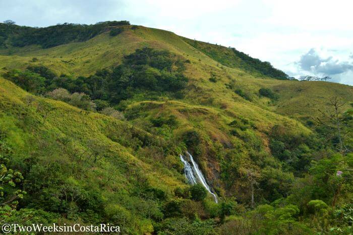
A couple of interesting stops we have enjoyed along this route are the Viento Fresco Waterfalls and a trapiche (sugar cane) demonstration.
Tips for Driving from La Fortuna to Monteverde
- Only drive this road in daylight hours (roughly 5:30 a.m. to 6:00 p.m.) since visibility can be limited by rain or fog and there are no guardrails. There are also only a few towns along the way, in case you break down or get stuck.
- Be sure to look carefully for the signs to Monteverde, as the road branches off in several spots.
- We recommend cross-referencing your Waze app or Google Maps as you go. Keep in mind that there are some dead zones with no service.
Here is a short video of the drive to Monteverde on Routes 145 and 606 from Tilaran.
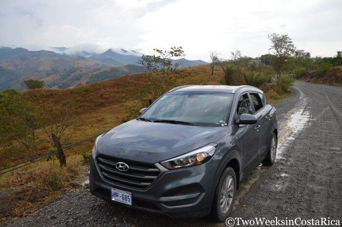
Rental Car Tips
If you haven’t rented a car yet, check out our Rental Car Discount to save some 10% and get free extras like a free second driver, free car seats for kids, use of a cooler, and more.
Best Car for La Fortuna and Monteverde
If you are planning to visit both Monteverde and La Fortuna, road conditions change constantly throughout the year on Route 145 from Tilaran to Santa Elena. One day, the road might be fine, and another, it could be a muddy mess after a big storm. Crews grade the roads periodically, which makes a big difference, but not on a set schedule.
Since it can be hard to know what to expect for your visit, we recommend a vehicle with 4-wheel drive year-round. Although during the drier months (December to April), it is often possible to make the trip without one, you won’t know exactly what you’re in for until you get here. Some years we get a lot of rain in December and January for example, while other years are very dry.
If you decide to rent a 4×2 car during the typical dry season, we still recommend an SUV with higher clearance so that the ride is not as rough and bumpy. In the rainy season (May to November), a 4×4 is highly recommended because road conditions can change quickly with heavy rain.
Best Car for Pacific Coast or San Jose and Monteverde
If you are visiting Monteverde via Route 606 or 145 (from Route 1), a 4×4 isn’t necessary. However, you may want one for peace of mind or at least a bigger 4×2 car if you plan to explore the area. Some of the roads leading to activities (e.g., zip lining, hanging bridges) are still dirt and can get slippery. We once stayed at a hotel up a steep dirt road in Monteverde and saw the driver of a small 4×2 sedan get stuck, spinning the tires on loose gravel. Even though the roads getting to Monteverde might be fine, you never know what you’ll encounter once you arrive.

Conclusion
Hopefully this post has prepared you for the beautiful, but adventurous, ride to Monteverde. Once you do get to this amazing region, you’ll be able to relax and experience all the wonders of the cloud forest. It’s a magical spot that is definitely worth the effort.
Have you driven to Monteverde lately? We’d love to hear your report. When did you go and how were the roads? Leave a comment below.

Looking for more info to plan your trip? Check out these posts:
Driving in Costa Rica – Not all roads are as rugged as the ones going to Monteverde but there is still a lot to know about driving in Costa Rica. Read our Driving post for more info.
Monteverde: A Forest in the Clouds – Our complete destination guide with things to do, restaurants to try, and local tips.
La Fortuna: What to Expect – If you are heading to La Fortuna before or after your time in Monteverde, check out this article first. Includes our picks for activities, restaurants, and hotels.
Monteverde Tours – Area highlights like nature walks, hanging bridges, zip-line tours, and coffee tours. See the activities we recommend in Monteverde and leave the arrangements up to us.
Driving Conditions from Liberia (LIR Airport) to La Fortuna – If you are landing in Guanacaste and visiting La Fortuna first, this post is for you.
Practical Travel – Get other practical information like weather, handling money during your trip, safety, and much more.
